June 2002
Covered Bridge Abutment at Hampton
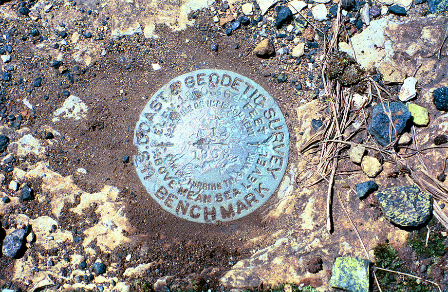
This is the USGS benchmark that is embedded in the
ledge of the abutment in Hampton for the covered thru bridge.
Another thing that I had wanted to get a photo of for years.
Why, you ask? Because it was there. It's number A12 set in 1933.
The elevation here is 1800.364 feet above mean sea level. These
are interesting to find and document as there are a good number
of them set into the ET and the LRRy ROW in 1933 and you can
check the elevations of the railroad easily. Thanks to the internet
and the release of USGS data about its benchmarks, it's now become
a hobby for thousands to find and document these things. Check
it out sometime. Also, note the black ballast rocks in the photo.... tailings straight out of the Cranberry Mine.
|